India and neighbour countries
INDIA AND NEIGHBOUR COUNTRIES:-
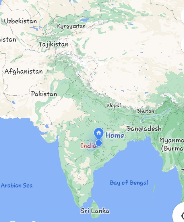
India rank second in the world on the basis of population and it is the 7th largest country in the world by area .Whose capital is Delhi. India is surrounded by water on three sides and is has seven neighbouring countries the north.The border between India and their neighbouring country is determined by lines.
The neighbouring countries of india and their expansion to the states of India:-
Pakistan
Its capital is Islamabad.Its extend to Gujrat,Punjab,Rajasthan and Jammu kashmir of India.it was separated from India from 14th August 1947 and formed a new country.The border between Pakistan and India is detrmined by the ‘REDCLIFF LINE’.

Afganistan:-
Its capital is Kabul.It extends to Jammu kashmir of India.The Durand Line is between India and Afganistan.The Durand line was founded by Henry Durand in 1896 hence the name Durand line.It forms the shortest border with India which is 106 kilometer.

China:-
Its capital is BIZING. It touches Jammu and kashmir,Himanchal prades, Uttarakhand,Sikkim and Arunchal prades of Inida. Mcmohan line is between India and China.This line was determined in 1914 by Henry Mcmohan.

Nepal:-
Its capital is KATHMANDU.It is connected to Uttar prades , Uttarakhand,Bihar,West bengal and Sikkim in India.

Bhutan
Its capital is Thimpu

Myanmar:-
Its capital is NAPYIDA.Between India and Myanmar is the hill of ARAKANT which form the boundary line between these two.

Bangladesh:-
Its capital is Dhaka.Its touches Tripura,West bengal,Assam in Inida.It is the longest border forming country with Inida which is 4096 kilometer.There is a Redcliffe line between India and Bangladesh which separates the two.

Note:-
- The country making the biggest border with India- Bangladesh (4096 km)
- The country making the smallest border with India - Afganistan (106 km)


Hindi translation:-
भारत और पड़ोसी देश:-
जनसंख्या के आधार पर भारत का दुनिया में दूसरा स्थान है और यह क्षेत्रफल के हिसाब से दुनिया का 7 वां सबसे बड़ा देश है। भारत तीन तरफ से पानी से घिरा हुआ है और इसके उत्तर में सात पड़ोसी देश हैं। भारत और उनके पड़ोसी देश की सीमा रेखाओं से निर्धारित होती है।
भारत के पड़ोसी देश और भारत के राज्यों में उनका विस्तार: -
पाकिस्तान
इसकी राजधानी इस्लामाबाद है। यह भारत के गुजरात, पंजाब, राजस्थान और जम्मू कश्मीर तक फैली हुई है। यह 14 अगस्त 1947 को भारत से अलग हो गई थी और एक नए देश का गठन किया था। पाकिस्तान और भारत के बीच की सीमा को 'REDCLCL LINE' द्वारा बंद कर दिया गया है।
अफगानीस्तान: -
इसकी राजधानी काबुल है। यह भारत के जम्मू काश्मीर तक फैली हुई है। डूरंड रेखा भारत और अफ़गानिस्तान के बीच है। डूरंड रेखा की स्थापना 1896 में हेनरी डूरंड ने की थी इसलिए इसका नाम डूरंड रेखा है। यह भारत के साथ सबसे छोटी सीमा बनाती है जो 106 किलोमीटर है।
चीन:-
इसकी राजधानी BIZING है। यह जम्मू और काश्मीर, हिमांचल प्रदेश , उत्तराखंड, सिक्किम और अरुणांचल को छूता है। मैकमोहन रेखा भारत और चीन के बीच है। यह रेखा 1914 में हेनरी मैकमोहन द्वारा निर्धारित की गई थी।
नेपाल: -
इसकी राजधानी काठमांडू है। यह भारत में उत्तर प्रदेश, उत्तराखंड, बिहार, पश्चिम बंगाल और सिक्किम से जुड़ा है।
भूटान: -
इसकी राजधानी थिम्पू है।
म्यांमार: -
इसकी राजधानी NAPYIDA है।भारत और म्यंमार के मध्य है अराकान्त की पहाड़ी है जो दोनों के बीच की सीमा रेखा बनाती है।
बांग्लादेश: -
इसकी राजधानी ढाका है। यह इनिडा के साथ सबसे लंबी सीमा बनाने वाला देश है, जो 4096 किलोमीटर है। भारत और बांग्लादेश के बीच एक रेडक्लिफ रेखा है जो दोनों को अलग करती है।
ध्यान दें:-
भारत के साथ सबसे बड़ी सीमा बनाने वाला देश- बांग्लादेश (4096 किमी)
भारत के साथ सबसे छोटी सीमा बनाने वाला देश - अफ़गानिस्तान (106 किमी)


No comments: